 We met a group of archaeologists working on a dig site on the island. They were excavating the site of a house and had removed many bricks from collapsed walls to establish their site where they had found the remains of buckles, nails, broken glass, pottery and timber. They worked on the island during the day and returned to a camp site on the Gordon River each night. Tasmanian Parks & Wildlife Service Officers were assisting with the project.
  We anchored overnight in Birch’s Inlet then set off the following morning in misty rain for the Gordon River. We were followed into the river by one of the large tour boats which stops at Heritage Landing about 5 miles upstream, this is the limit of their park permit.
  Here a well signposted boardwalk guides visitors through the different river side habitats and identifies many of the trees, mosses and ferns growing there. We are lucky to be able to travel much further upstream and motored up through gorges and bends in the river to Sir Johns Falls landing, where seaplanes land and tie up at a pontoon with a short walkway along the creek into the bottom of Sir John Falls.
  As we motored up the Gordon the skies cleared to a brilliant blue and Huon Pine spotting became a bit of a sport, as we were not too sure what the young trees looked like. Pat was able to identify some and this was confirmed when we later met up with Parks and Wildlife Service officers at Sir John Falls landing. Chris (PWS) was able to name some of the trees that we had observed and share his knowledge with us. He had the workers from the archaeological dig on Sarah Island with him and they were enjoying their first day off in over 2 weeks.
After lunch we put the dinghy in the water and motored up river through fast running rapids to the point where the Franklin River joins the Gordon River. At times like these we are thankfull for a good size outboard. Even with our 15Hp we were struggling to make headway against the current in some parts of the river.
 We were able to enter the Franklin River and motored as far as the first rocky island in the middle of the river where we went ashore. The river narrows after this point and many rapids, rocks and snares of fallen trees make navigating the river a challenge.
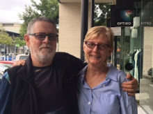
Crew clowning around in the Franklin River.

 That evening we enjoyed a full moon over the Gordon River with clear skies, unfortunately our photos don’t do this experience justice. The following morning we woke to sunshine and blue skies and after breakfast two seaplanes landed and tied up next to us at the pontoon.
  Later in the day as we headed down the river one of the planes flew past us at tree height level winding down the river – that would have been a buzz.
  Before we departed Sir John Falls we took the explored the shores downstream and a hut that was built by the company that was going to build the Gordon below Franklin Dam. This area was the location of all the protests to stop the dam in the 1970’s. The hut is now used by kayakers as they travel down the river as an overnight stop.
We stopped at Heritage Landing boardwalk as the tour boats were not due for another hour and appreciated the work done by the Parks and Wildlife Service to provide information about the river, its history and the environment as it is today.
 That evening we anchored in Kelly’s Basin the site of the two towns of East and West Pillinger. The following morning we went ashore and explored East Pillinger where a former brick works and railway line terminated bringing coal from the Mt Lyall Mine. Again PWS have provided a boardwalk through the ruins of the old settlement with information boards describing the history and workings of the town.
 Not much remains of West Pillinger except an old railway carriage that has been converted into a fisherman’s hut and the remains of the old wharf.
After lunch we prepared the boat for departure and headed out of Macquarie Harbour north. This is one of most dangerous stretches of coast in Tasmania as it is exposed to the large south west swells with no safe anchorages until the top of Tasmania. That night we experienced strong winds 20 – 35 knots with large following seas which made for fast sailing. We had planned to stop at Three Hummock Island on the north west of Tasmania, however as we traversed Hunter Passage we checked the latest weather forecast and decided to make for Flinders Island across the top of Tasmania. As it was Good Friday we enjoyed chocolate Hot Cross Buns (purchased in Strahan). The trip to Flinders Island was not a quick as our trip up the coast and we just made it - the sun was setting as we anchored in Port Davies near large granite boulders covered in red lichen on Saturday evening April 2. The trip from Macquarie Harbour to Flinders Island took just under 54 hours and covered 324 Nm (600Km).

1 comment:
Continue you happy sailing adventures. Kevin & Delvine
Post a Comment